
Have you ever wondered what your local airport looked like during World War II? See aerial photos from the 1940s with our historical Airport Directory 3 volume set!
In late 2017 the Combat Air Museum at Forbes Field in Topeka Kansas kindly let us digitize their 3 volume set titled “Airport Directory of the Continental United States”. These volumes were published by the Army Air Force in 1944, and might sound pretty boring at first, but are actually a treasure trove of information. Each volume clocks in at around 1,000 pages and is cataloged alphabetically from Alabama to start volume 1, to Wyoming at the close of volume 3.
Information For Every State
Each state, or chapter, in the airport directory begins with an alphabetical list (by airport name) of all the functioning airports at the time of publication. The list of airports is also given a numerical value, and any alternate or superseded airport names are indicated by an asterisk at the start of the index. The airport name is then followed by the city it is located in, and an index code that corresponds to its location on the state map that follows the index. The index codes function like the grid on a normal map, and consist of a single letter followed by a dash and numeral.
Each state map indicates cities and towns with a black circle, and “airports and seaplane anchorages” with a red dot. In the case of a large city or congested area, an insert is shown in more detail – such as Los Angeles (seen in the circle below).


Specific Airports
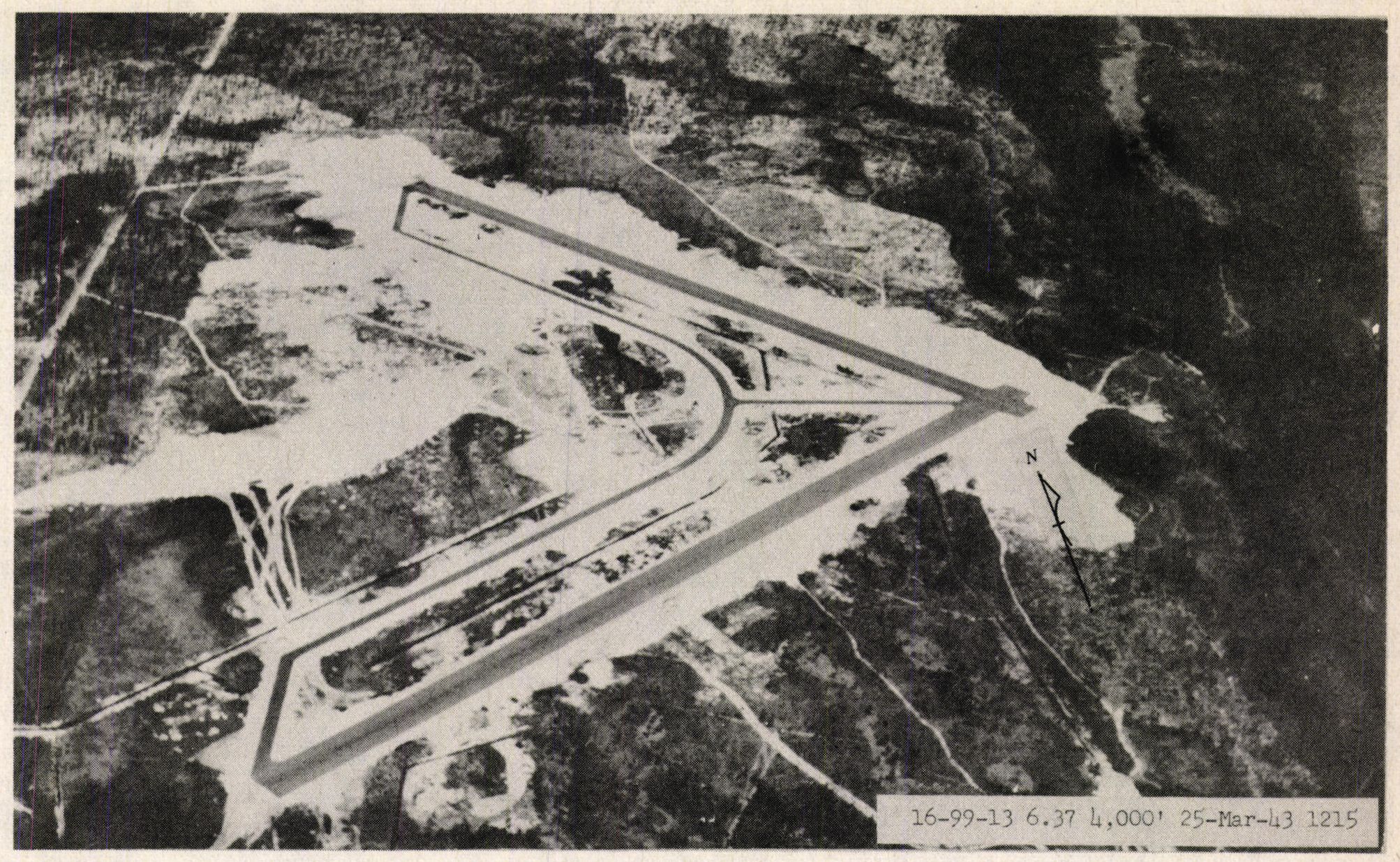
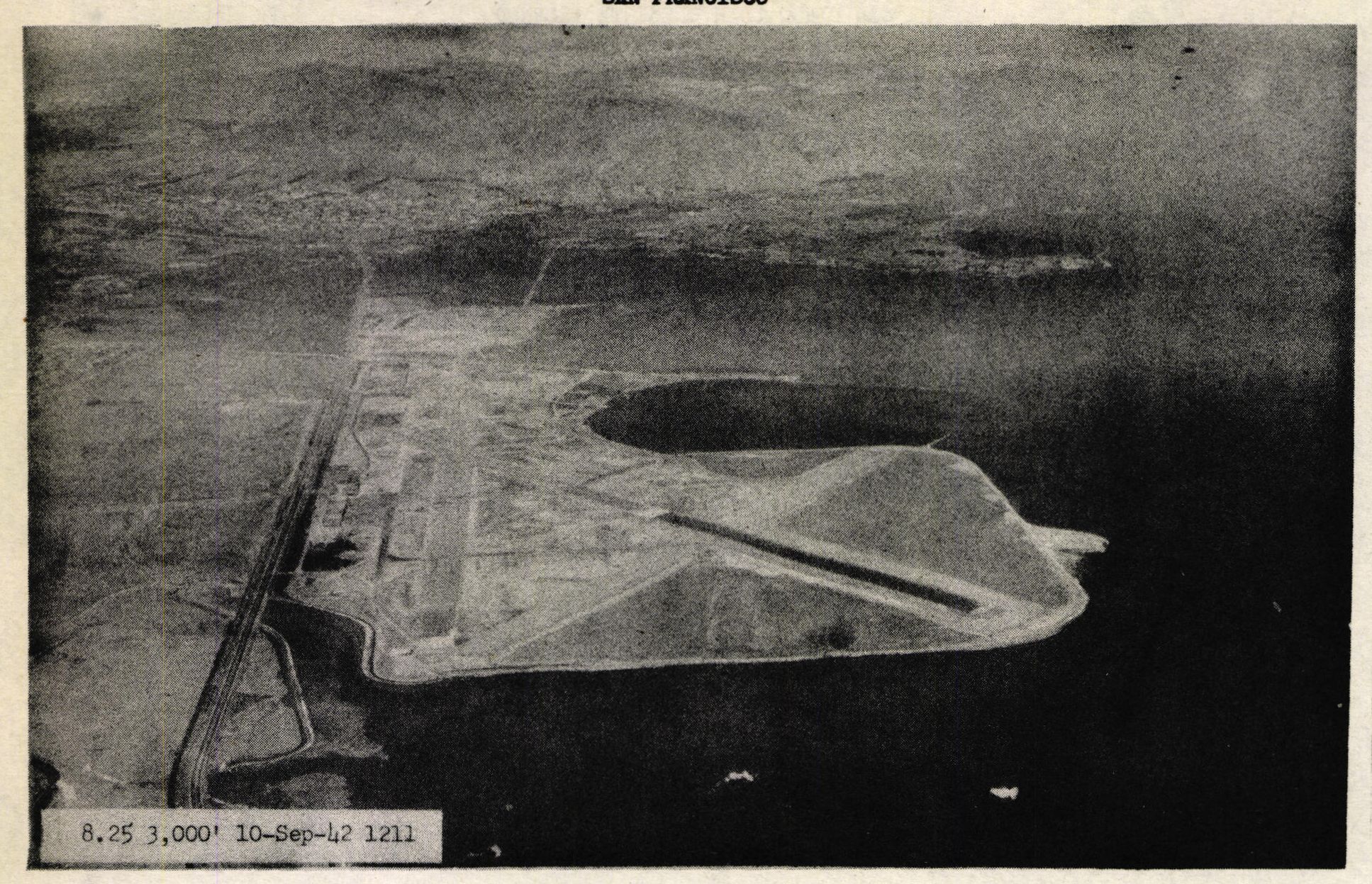
Following the state map, each airport in the state is then given a single page of information. The page for each airport contains a dated photo of the airport if available (there are a handful of airports throughout the volumes with no photo). Information on airport location, altitude, and city population is followed by a description that includes the airport size, shape, runway length, obstructions, and lighting. General and radio facilities are also covered, along with information on weather tendencies including temperature and prevailing winds. Transportation options such as railways and roads precede owner/operator details.
It’s fascinating to see how some of the larger airports have changed – or stayed the same, since World War II, how some of the smaller airports have grown, and how many airports don’t even exist anymore!
Below - Akron Municipal Airport (7-Oct-1943 & present day)


Below - Jacksonville Florida Municipal Airport (25-Mar-1943 & present day)

Below - San Francisco Municipal Airport (Mills Field) (10-Sept-1942 & present day)

Take a Look
Currently all three volumes of the directory are only available to members of the AirCorps Library website (click here for more information about becoming a member for just $9 per month or $75 per year!). These airport directories are a great research tool for anyone looking to know more about WWII era airports stateside, and we are happy to have it as part of the site!